

Parassinikkadavu Snake Park

Important facts
From Wikipedia's lists and Wikidata, which cite UNESCO, the Ramsar Convention, the NTCA and the Ministry of Environment.
Timings, tickets and the route from Parassinikkadavu.
Snake Park on the Parassinikkadavu pagesFind the way there.
Route on the mapAnimals of Parassinikkadavu Snake Park 2
Threatened, on the IUCN Red List 1
Critically Endangered, Endangered, Vulnerable or Near Threatened.

Other animals 1
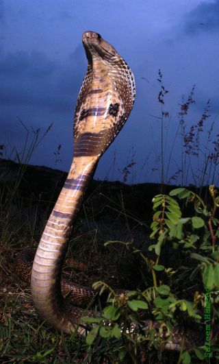
Animals named in its Wikipedia article (CC BY-SA 4.0, not a government source), which may name animals seen once or no longer found there. IUCN status: Wikidata, from the IUCN Red List. Found only in India: Wikipedia's list of India's endemic animals. Photos: Wikimedia Commons.
About
The Parassinkkadavu Snake Park is located in Parassinikkadavu, Anthoor Municipality, Kannur district, north Kerala in south India. It is about 16 kilometres from Kannur city and about 2 kilometres from National Highway 17, en route to Taliparamba from Kannur.
About text: Wikipedia (CC BY-SA 4.0), shortened.
Cities nearby on our pages


Tags and facts: Wikidata (CC0), from UNESCO, the Ramsar Convention, the National Tiger Conservation Authority and the Archaeological Survey of India; lists and descriptions from Wikipedia (CC BY-SA 4.0), not a government source; biodiversity hotspots from Conservation International's 2016 map (CC BY-SA 4.0); photos from Wikimedia Commons. Awards: the source named with each.